


Reference
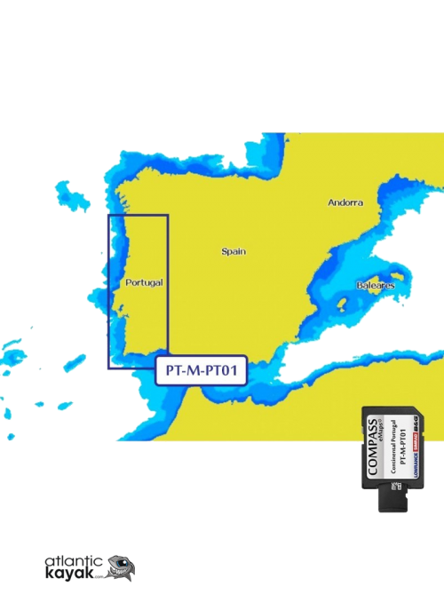
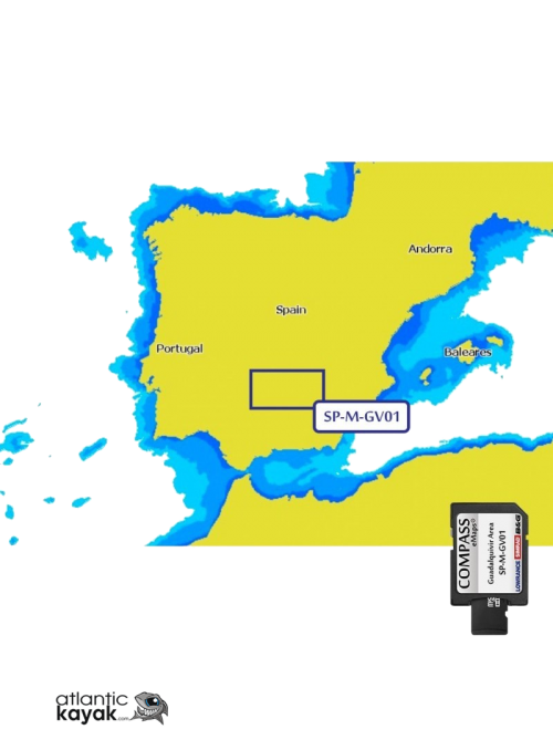
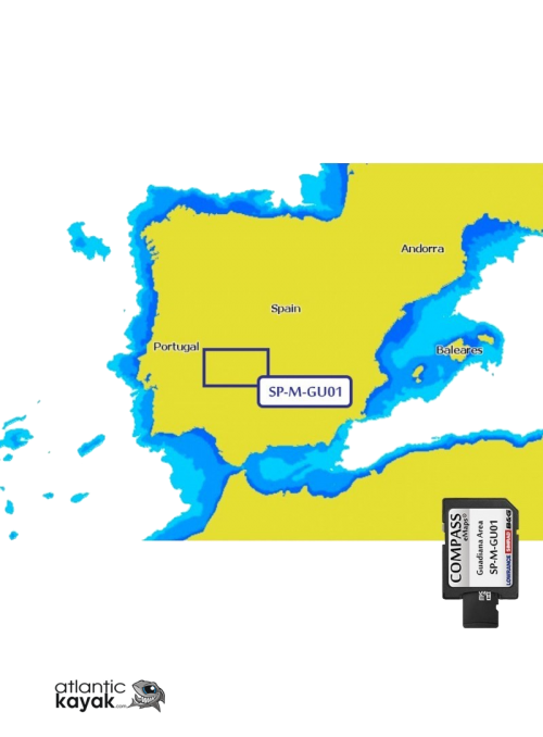
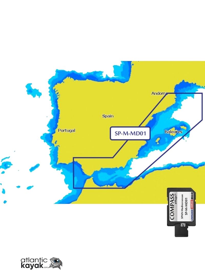
MAP COMPASS LARGE SPAIN MEDITERRANEO
GREAT LEVEL OF DETAIL, NAVIGATION AIDS AND PROFUNITY INTERVALS OF 2.5 AND 10 METERS
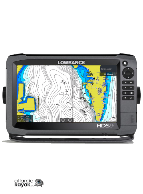
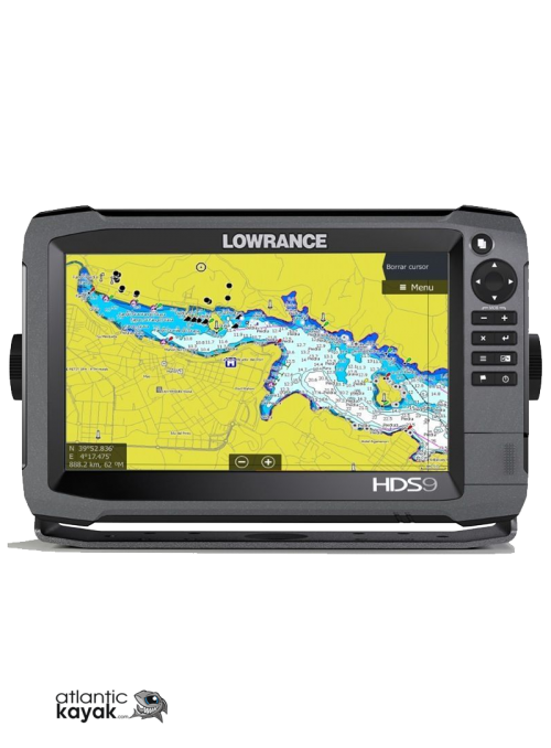
COMPATIBLE WITH ANY EQUIPMENT IN THE HOOK, ELITETI HDSGEN2, GEN3, GOXSE, NSSEVO2 AND NSSEVO3 RANGES
Discover the entire Mediterranean coast of the Iberian Peninsula in a single menu
Dare to explore with compass eMaps Mediterranean, either by waters near your usual departure area or hundreds of miles away. Compass eMaps Mediterranean will provide you with mapping information and high-precision navigation aids throughout the peninsular Mediterranean coast; From the coast of Huelva to the north of the province of Girona, passing through the stretch of Gibraltar and including the Balearic Islands.
Explore. like fish in the water
"Move like a fish in the water and know perfectly the marine environment around you thanks to the contour lines offered by compass eMaps Large.Know the composition of the seabed in certain areas: Compass eMaps Large tells you if it is sand, mud, shell, stone... etcIdentify structures or steep slopes in your environment thanks to the probes included in your cartography, detect critical areas with pronounced depressions, learn about structures that rise above the bottom, or detect sharp lines of stones at certain points. "
Exclusive development. infinite resources.
Developed based on the latest updates from the Navy hydrographic Institute and the British Admiralty, Compass eMaps LARGE is a product exclusively designed for Lowrance, Simrad and B&G products. The specialization by zones and the careful selection of each of the product's performance, guarantee a high level of precision in each of the covered bodies of water.
Accuracy in all your outings with navigation aids
Enjoy the great detail of the bathymetric lines offered by the commas eMaps LARGE mapping of your favorite reservoirs or swamps, or navigate with confidence with a high-precision map of your preferred coastline. With Compass eMas LARGE you will have the best navigation aids; Locate lighthouses, buoys, practice meeting points, restricted areas, obstruction zones or prominent buildings near your location. Depth intervals at 2.5 and 10 meters ensure safe navigation in the most critical areas when you need it most. In addition, with the LARGE version you will get additional probes in the areas closest to port, so that nothing escapes you. If you are a deep water navigator, you will get bathymetric lines with intervals of 10 meters from 50 meters deep and 50 meters from 100 meters, being able to reach depths of up to 1,000 meters.